The FMCG Supply Chain Flow
Step 1: Multi-Tier Supplier Mapping & Geolocation
The flow starts by mapping the entire supply chain from “Plot to Port.” We collect geolocation coordinates (polygons) for every supplier, ensuring that the origin of raw materials like coffee, cocoa, or palm oil is verified at the source.
Step 2: Automated EUDR & Social Risk Screening
Utilizing our 6-satellite ecosystem and DDS algorithms, the platform automatically screens for deforestation (EUDR) and social risks (Child Labor/Forced Labor). This ensures that every shipment meets strict European market entry requirements before it leaves the origin country.
Step 3: Continuous Satellite Monitoring & Disturbance Alerts
- Once the supply chain is established, we monitor production areas in real-time. If the system detects fire, illegal logging, or land-use changes on a supplier’s plot, it triggers an instant “Live Alarm,” allowing for immediate procurement adjustments.
Step 4: Evidence Synthesis & The “Golden Folder” for Audits
The platform synthesizes all satellite imagery, legal declarations, and risk scores into an “Audit-Ready Evidence Pack.” This “Golden Folder” provides immutable proof for customs authorities and regulatory bodies, eliminating the risk of cargo seizure or fines.
Step 5: ESG Reporting & Carbon Footprint Transparency
In the final step, we quantify the carbon footprint and sustainability metrics of the supply chain. This data is integrated into an ESG dashboard, helping FMCG brands meet their net-zero targets and communicate their ethical commitment to consumers.

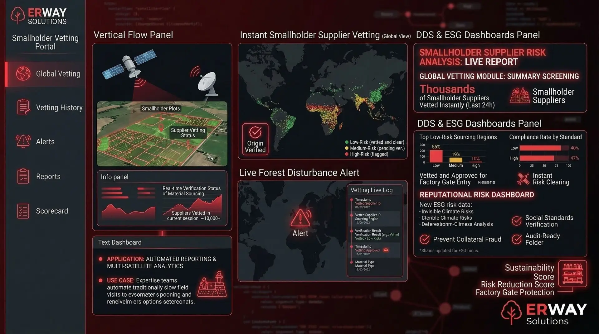
They use the platform to vet thousands of smallholder suppliers instantly, ensuring that only "low-risk" materials enter the factory gate, thus protecting the entire brand's supply chain.

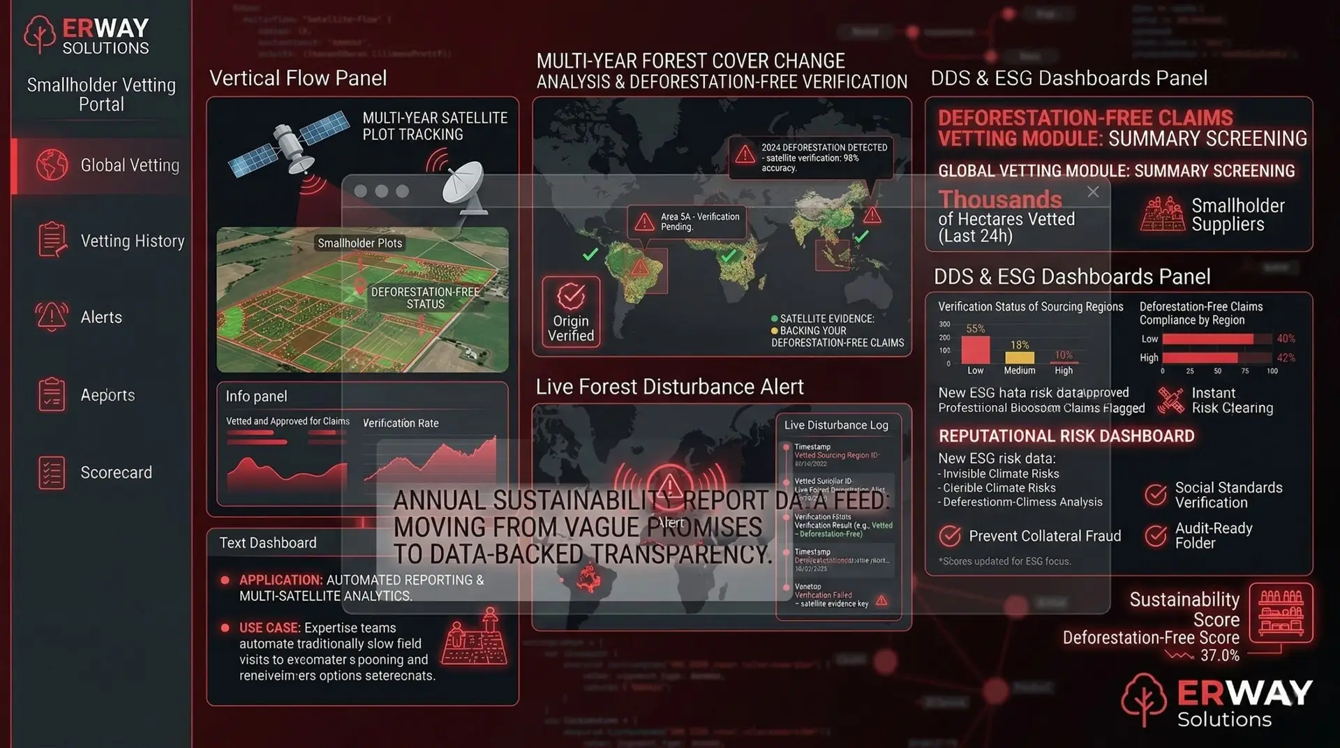
These managers utilize the year-by-year satellite evidence to back up their "Deforestation-Free" claims in annual sustainability reports, moving from vague promises to data-backed transparency.

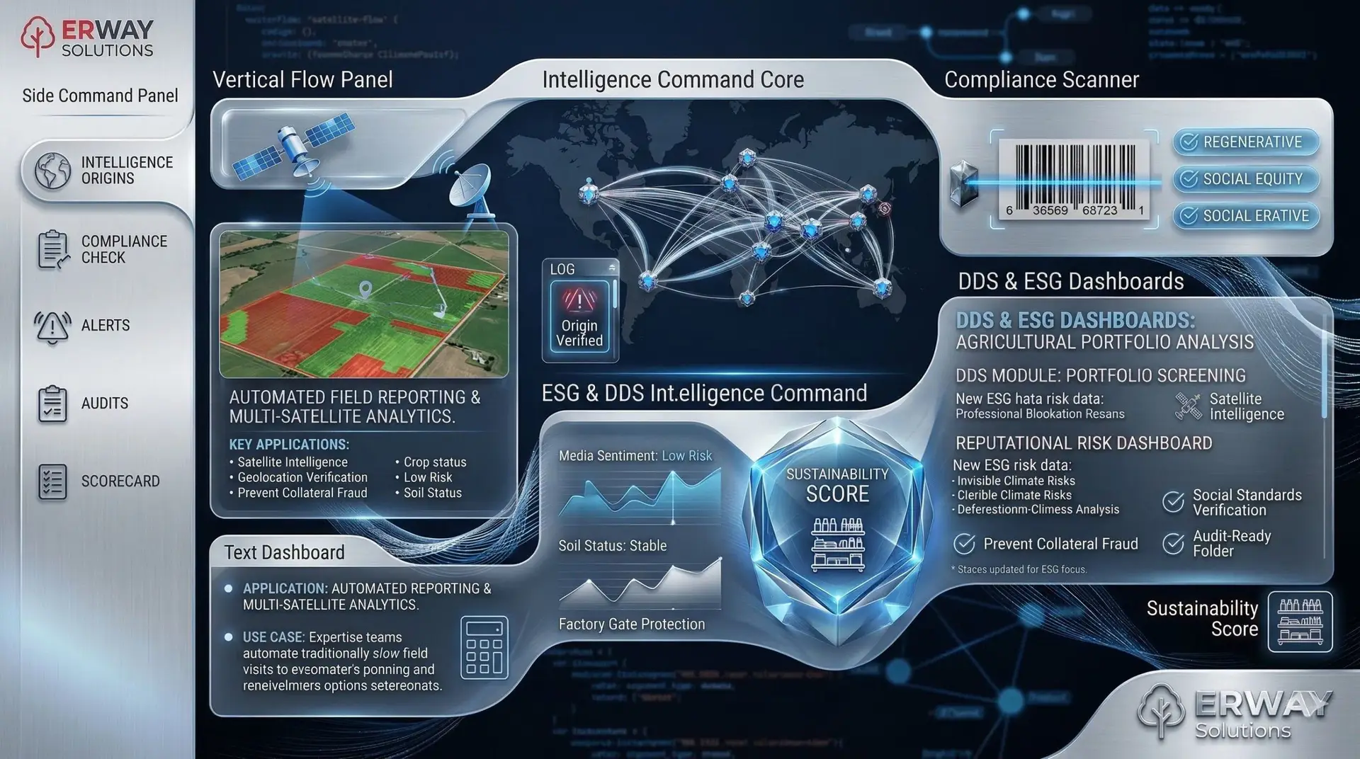
They use the platform to generate "Due Diligence Statements" required by EU authorities. This automates the legal paperwork and ensures that the company is 100% protected against EUDR and CSDDD penalties.

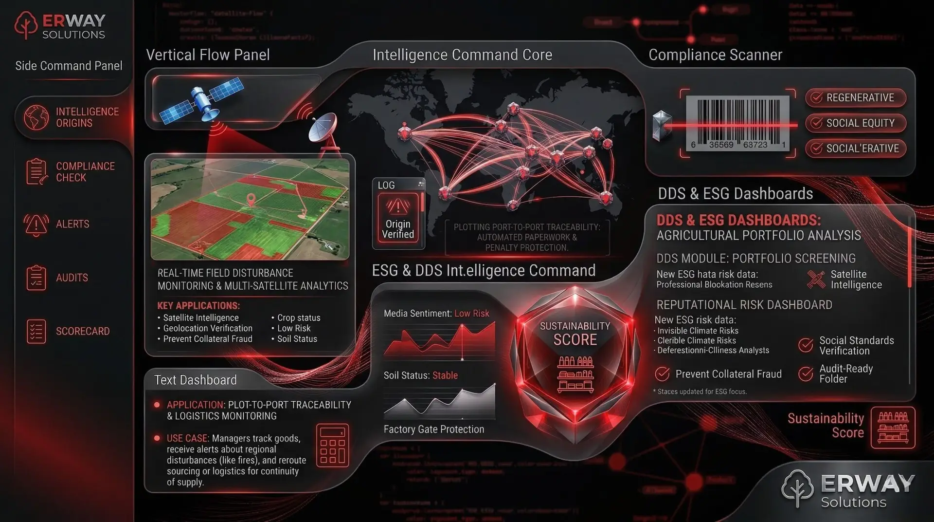
They track the flow of goods from plot to port. Real-time alerts about regional disturbances (like fires) allow them to reroute sourcing or logistics, ensuring continuity of supply.
how it worksEverything you need to know about
- Our platform is designed for scale, allowing bulk upload of polygons and automated mass-screening for entire supplier cooperatives.
- Yes, our multi-tier mapping allows you to trace back even to the sub-suppliers that provide raw materials to your direct partners.
- Without satellite-backed proof, cargo faces seizure, heavy fines, and a total ban from entering the EU market.
- Absolutely; every batch of raw material is linked to a specific set of geolocated plots via a unique digital ID.
- By comparing satellite imagery with local forest management maps and official EUDR 2020 cut-off criteria.
- Yes, all supplier data and sensitive geolocation information are stored with enterprise-grade security and full GDPR compliance.
- By alerting you to risks (like fire or drought) as they happen, giving you time to switch suppliers or adjust production schedules.


