The Agri-Finance Operational Flow
Step 1: Automated Collateral Valuation & Appraisal
- The process starts by digitalizing the appraisal phase. Instead of 45-day manual inspections, the platform provides instant plot-level verification of crop types and land productivity. This ensures that loan collaterals are valued based on objective, historical satellite data.
Step 2: 6-Satellite Continuous Risk Monitoring
- Once the loan is disbursed, our 6-satellite ecosystem monitors the collateral in real-time. This continuous oversight detects early signs of crop stress or land-use changes, ensuring the bank’s financial exposure is managed throughout the entire production cycle.
Step 3: Disturbance Scoring (The 0-8 Risk Scale)
We apply a standardized 0-8 Risk Scoring system to quantify field disturbances such as drought, frost, or disease. This allows banking units to categorize their portfolio risk objectively, identifying potential repayment issues long before they manifest as defaults.
Step 4: Audit-Ready Evidence for Credit Committees
- The platform synthesizes satellite imagery and health logs into comprehensive evidence packs. These reports provide credit committees with an immutable “Single Source of Truth,” reducing the margin for error and eliminating the risks associated with manual reporting.
Step 5: ESG Compliance & Sustainable Portfolio Growth
- In the final step, the data is integrated into ESG reporting dashboards. Banks can now quantify the environmental impact of their agricultural loans, satisfying regulatory transparency requirements and fostering a more resilient, sustainable credit portfolio.

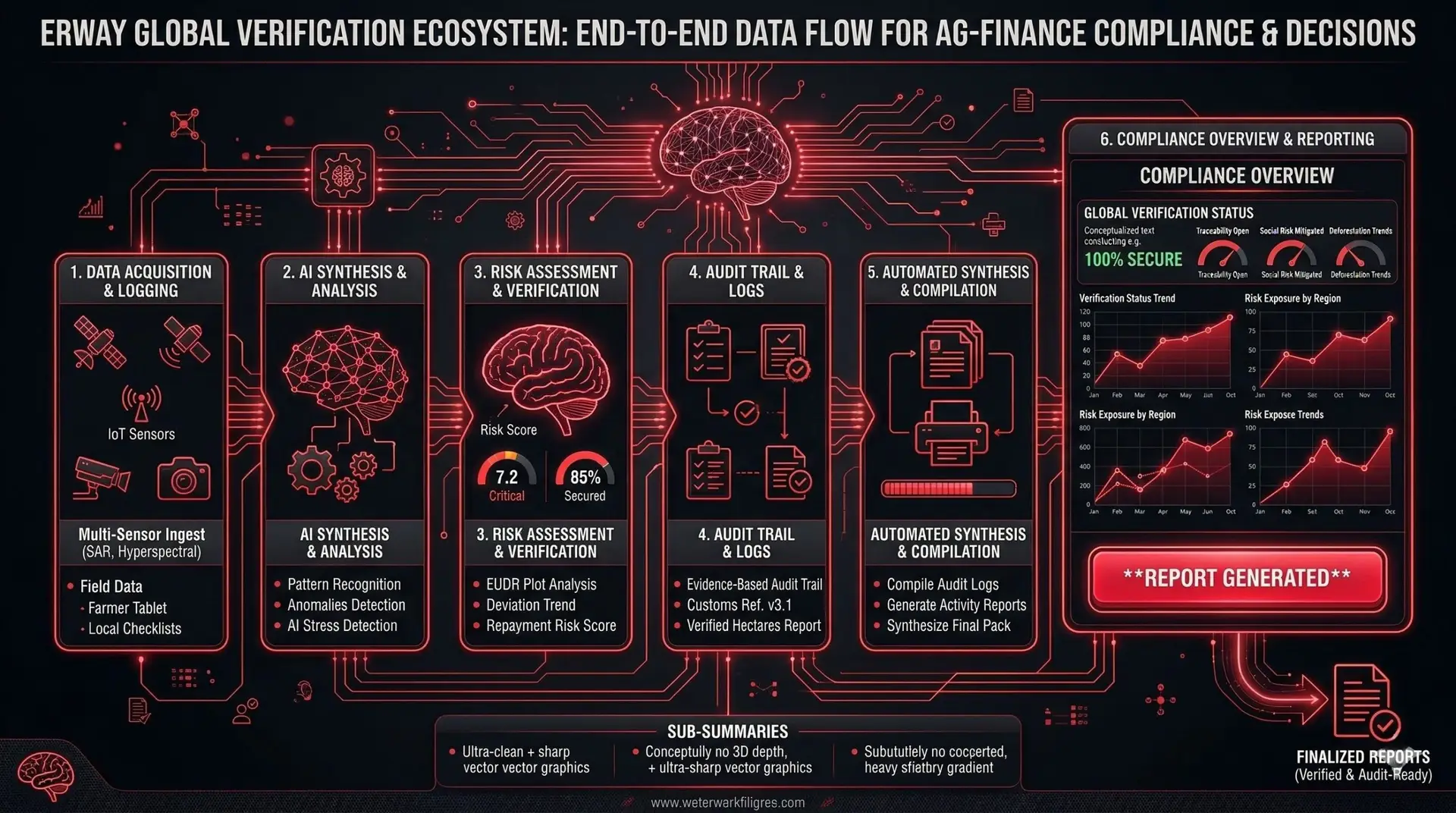
Managers use the platform to monitor the "repayment capacity" of farmers. By seeing the real-time health of the crop, they can restructure loans or offer proactive financial support based on expected yield volumes.

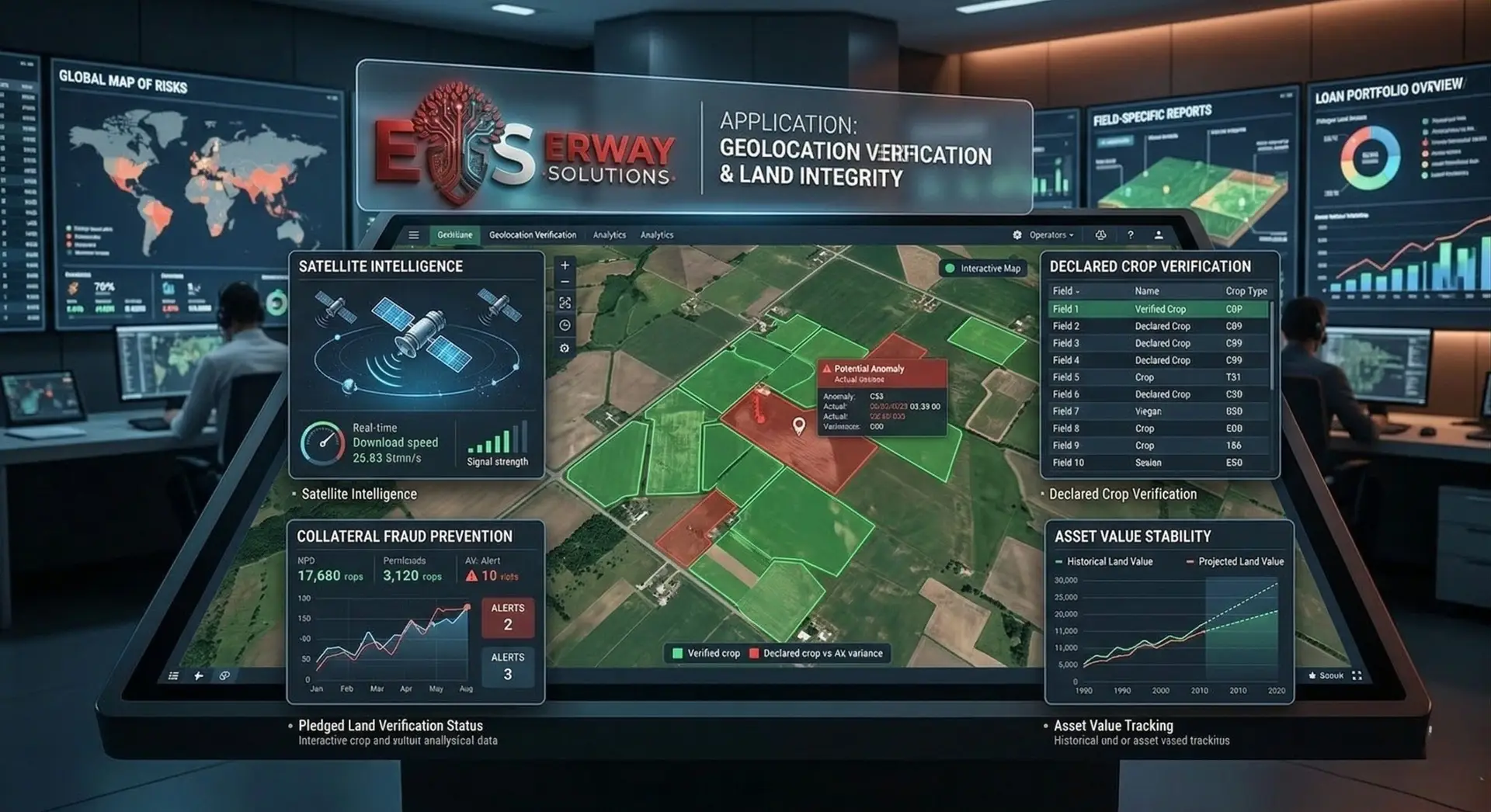
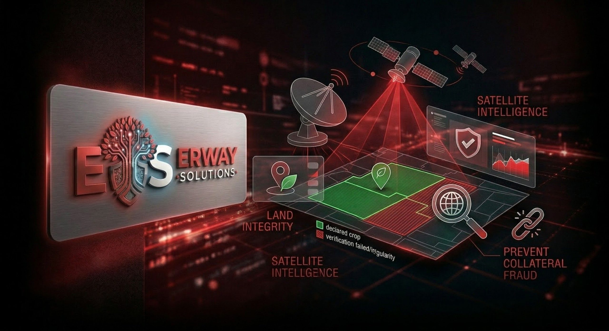
These units use satellite zekâsı to verify if the pledged land actually produces the declared crop. This prevents "collateral fraud" and ensures that the asset value remains stable throughout the loan term.

Expertise teams automate the traditionally slow field visits. By generating reports remotely, they reduce operational costs by up to 80% while increasing the frequency and accuracy of their asset audits.

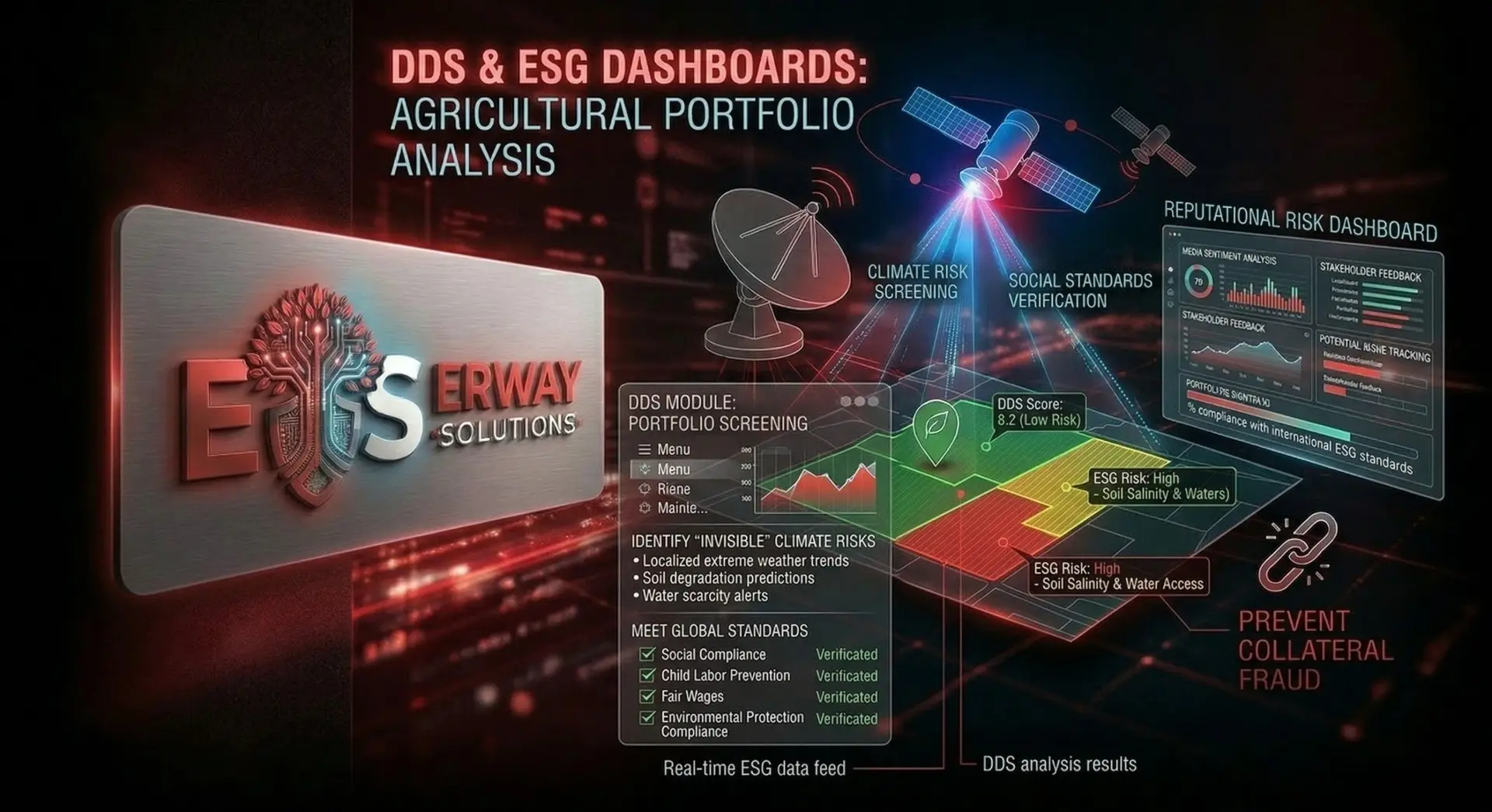
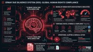
The committee utilizes the platform to screen agricultural portfolios for "invisible" climate risks. They use the DDS module to ensure that the funded projects meet global social and environmental standards, avoiding reputational risk.
how it worksEverything you need to know about
- By replacing manual field visits with automated, high-precision remote monitoring, reducing travel and labor costs.
- Yes; it verifies crop types and plot boundaries, flagging mismatches between customer declarations and satellite reality.
- A higher risk score triggers early warning alerts, allowing banks to adjust credit limits or collateral requirements proactively.
- Yes, our API infrastructure allows for seamless data integration into existing banking software and risk management engines.
- We provide audit-ready data on carbon footprint, land use, and social compliance for every agricultural loan.
- Yes; we offer up to 5 years of historical land performance data to help banks assess the creditworthiness of new clients.
- Our 6-satellite ecosystem provides updates as frequently as every 2-3 days, depending on cloud cover and region.
- Absolutely; our fire and drought stress maps are used by financial institutions to verify loss claims quickly and fairly.


