

Why ERWAY?
Redefining Agriculture with AI and Precision Simplicity
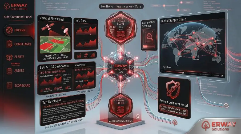
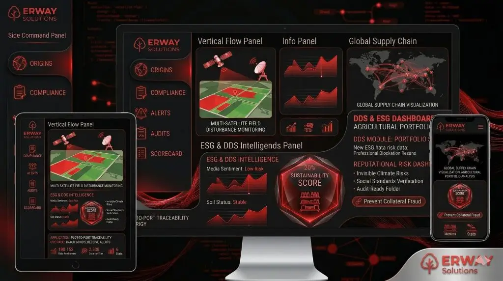
Integrated Solutions Portfolio
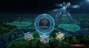
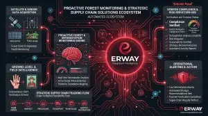
In an era of increasing environmental and regulatory complexity, ERWAY stands as the definitive bridge between raw data and operational success. Our platform leverages a sophisticated AI-driven ecosystem that analyzes multi-spectral data from 6 advanced satellites to detect “invisible” risks before they manifest. By identifying early-stage crop diseases, water stress, and subtle deforestation patterns with surgical accuracy, we empower our partners to transition from reactive crisis management to a proactive, data-driven strategic advantage.
The core of our philosophy is Operational Simplification. We understand that the future of agriculture lies in removing friction from the supply chain; therefore, we automate the most labor-intensive processes of modern trade. From reducing the 45-day manual appraisal cycles in banking to just 1 hour of remote satellite verification, to generating “audit-ready” EUDR and DDS evidence packs with a single click, ERWAY removes the administrative burden, allowing agribusinesses and financial institutions to focus on growth rather than paperwork.
Choosing ERWAY means securing a “Single Source of Truth” that is globally recognized and technologically unparalleled. We don’t just provide maps; we provide an integrated geospatial truth engine that ensures absolute transparency across environmental and social pillars. Whether it is optimizing yield through VRA mapping or ensuring 100% compliance with international mandates, ERWAY provides the intelligence required to navigate the complexities of the 2026 global market with absolute confidence and integrity.
ERWAY transforms the complexity of global mandates into a simplified digital advantage through AI-driven satellite zekâsı. We bridge the gap between field reality and regulatory security, ensuring your operations are both precise and audit-ready.
Our AI detects nutrient deficiencies and stress factors early, allowing for targeted interventions that reduce input costs (water/fertilizer) by up to 20% while maximizing harvest quality.
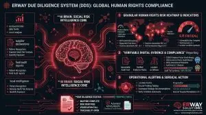
Yes; the platform automatically synthesizes geolocation data and satellite evidence into a “Golden Folder,” eliminating the need for manual reporting and protecting you against heavy penalties.
Absolutely. Our API-first architecture is designed for seamless integration, allowing you to pull real-time risk scores and field data directly into your current management systems.
Standard tools often fail under cloud cover; our multi-satellite sync ensures continuous monitoring and high-resolution data regardless of weather conditions, providing unrivaled accuracy.
get in touchWe are always ready to help you and answer your questions
International Sales & Support For inquiries within Europe and international sales consultations:
Location: Vienna, AUSTRIA
Global Headquarters Our main hub for operations and innovation is located in the heart of Istanbul.
- Address: Antasya Residence, Umraniye, 34768, Istanbul / TURKEY
Mail: iletisim@erway.com.tr
